Our Heritage: Chattogram
The Gateway to Bengal - A Crossroads of Civilizations
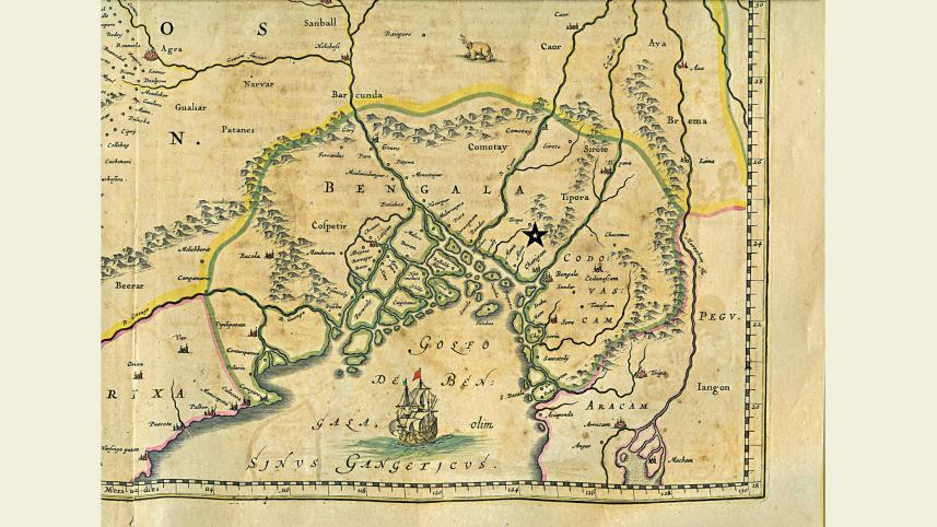
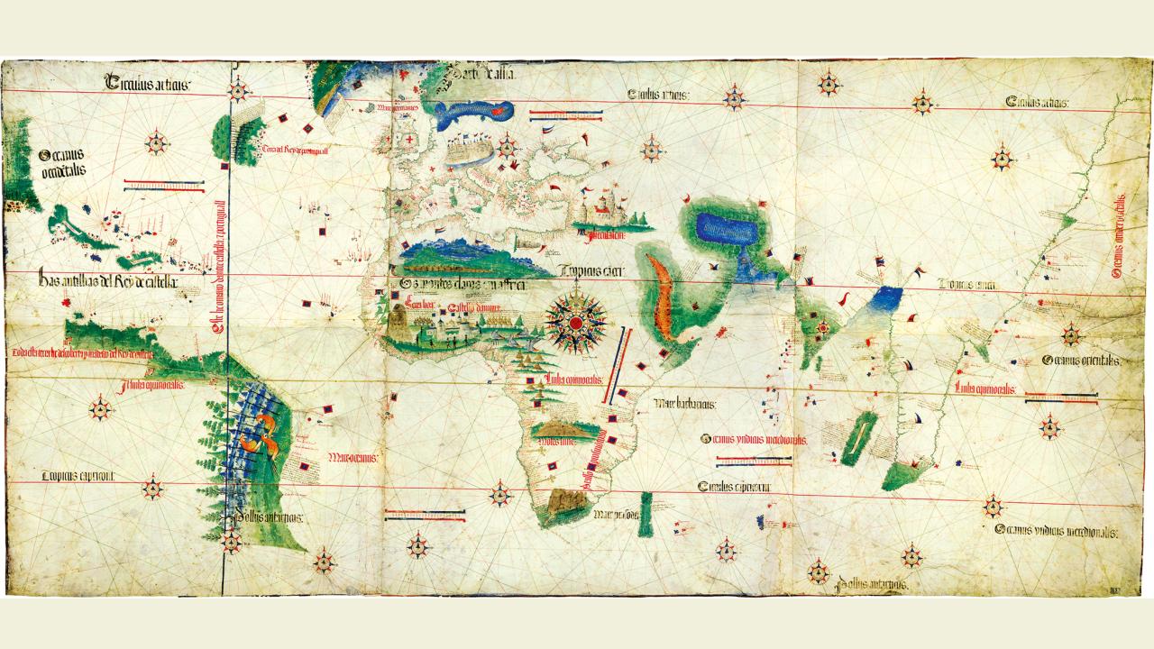
Joan Blaeu's 17th century map showing the Chittagong region
A Port of Many Names
Chattogram has been known through history by many names, reflecting its multicultural significance: Chattagrama in Sanskrit, Samandar by Arab traders, Porto Grande by the Portuguese, and Islamabad during the Mughal era.
Located at the Bay of Bengal's apex where medieval Bengal, Arakan, and Tripura kingdoms intersected, Chattogram emerged as one of the most important ports in South Asia. The region east of the Karnaphuli River features a dynamic ecosystem with shifting islands, mangroves, and waterways that continuously evolved through natural forces.
The port functioned as a crucial entrepôt connecting three major trade circuits: the Indian Ocean network, the Brahmaputra-Tibet-Yunnan river routes, and the Maldivian cowrie trade. Merchants exchanged textiles, spices, precious metals, and foodstuffs, making Chattogram central to regional commerce for centuries.
Historical Maps of Chattogram
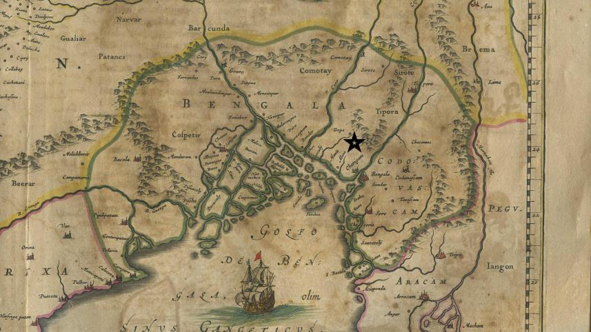
Joan Blaeu's Map (c. 1640)
Depicts Chittagong as a key coastal node linking Bengal's riverine networks with the Indian Ocean
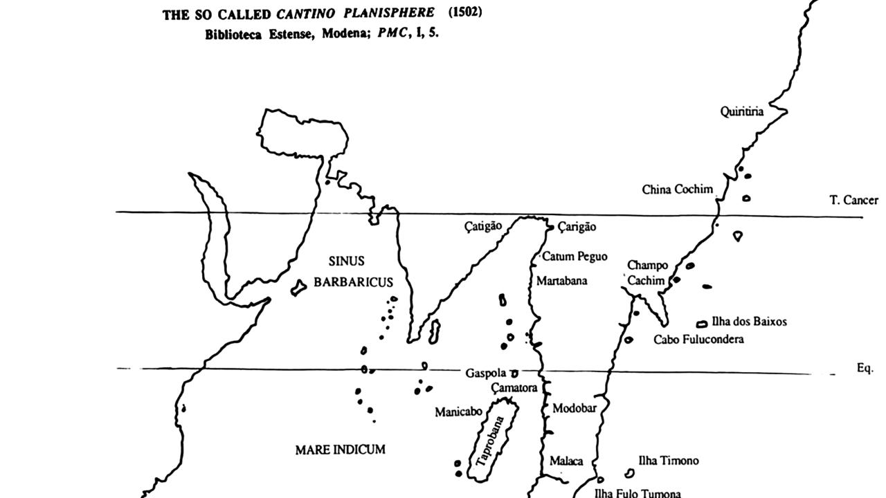
Cantino Planisphere Detail (1502)
Shows Catigao (Chittagong) marked along the Bay of Bengal in early European maps
The Cantino Planisphere (1502)
One of early cartography's most significant documents showing global maritime trade routes
Maritime Trade Hub
Connected Indian Ocean, Brahmaputra-Tibet-Yunnan & Maldivian cowrie trade routes
Strategic Location
Where Bengal, Arakan & Tripura kingdoms intersected at the Bay of Bengal
Cultural Crossroads
Sanskrit, Arab, Portuguese & Mughal influences shaped its diverse identity
Dynamic Ecosystem
Shifting islands, mangroves & waterways east of the Karnaphuli River